


Visit us
We welcome visitors to Minyma Kutjara Arts Project in Irrunytju community and a permit is required to enter Ngaanyatjarra Lands which you can obtained from the Ngaanyatjarra Council (Aboriginal Corporation) in Alice Springs. Irrunytju is located on the border of the Ngaanyatjarra and Pitantjatjara Lands of the Gibson Desert in Western Australia, 10 kilometres from the tri state border of South Australia and the Northern Territory.
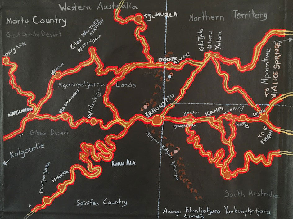
Surveyor Generals Corner marks the intersection between South Australia, Western Australia and the Northern Territory, situated at Warapulli Homeland, 10 km from Irrunytju. Access is limited to guided tours and a visitors permit is required from Irrunytju Community.
Giles Weather Station is 162 km north west of Irrunytju and named after the English explorer Ernest Giles who traveled through the area in 1874. Situated on the Great Central Road of Western Australia, it plays an important role in climate observatory. Visitors are invited to watch the daily release of weather balloons.
Uluru – Kata Tjuta National Park is owned by the Traditional Owners from Mutitjulu Community and jointly run by Anangu and Parks Australia. This World Heritage listed park is 300km north east of Irrunytju and holds important Tjukurpa and a special place for Mens’ Law and Culture Business.
The city of Kalgoorlie derived from the Wangai word Karlkurla, an edible silky pear that grows through the region, is 1,162 km west from Wingellina.
Mparntwe (Alice Springs) nestled between the East and West MacDonnell Rangers is 738 km from Wingellina and the last major town if you are heading from Eastern Australia.
Talk to us
Minyma Kutjara Arts Project
Irrunytju (Wingellina) Community
Ngaanyatjarra Lands
Western Australia
Postal:
PMB 52
Wingellina
Via Alice Springs NT 0872
Email: minyma.kutjara@minymakutjara.com
Instagram: @minyma_kutjara_arts